The Significance?
This is significant since ice has a high albedo factor. That is, it reflects most of the suns light and heat back into space. As more and more of the Arctic ocean is ice free, more and more of the sun's heat is absorbed. Thus, the ocean's temperature increases, and less ice is formed in following years. This feedback process has been well underway for the last few decades.
When the Arctic ocean north of Greenland becomes ice free each summer, then the air masses bringing weather to Greenland will be above freezing. In the past, the ocean north of Greenland was ice covered year around. When their is north of Greenland, then the melting of the Greenland Ice Cap will begin in earnest. I believe it will enter what I call "hyper-melt" mode. With the warmer air coming to Greenland for longer summer periods. Then Greenland's ice will melt in earnest. I would not be surprised to see an increase of melting by an order of magnitude.
 |
| Satellite view of Arctic 05/012000 Note the color is dark purple indicating the ice covers the water 100% |
How Do I know? I regularly go to the Cryosphere Today site maintained by the University of Illinois. This site has satellite images of the Arctic showing the ice coverage. The images of the ice are color coded showing the density of the coverage. Dark purple for complete coverage through light blue for almost no coverage, and black for less than 15% ice. If you look at all previous years for May 1, you will see dark purple over all the Arctic.
Well, for 5/01/2011, you not see dark purple everywhere. You will a lot of light purple, red, yellow, and green. That means that the Arctic ice is not completely covering the ocean. It means that the cold Arctic air is not cold enough to overcome the heat of the Arctic ocean and freeze it over. Therefore, this ice will melt very fast this summer.
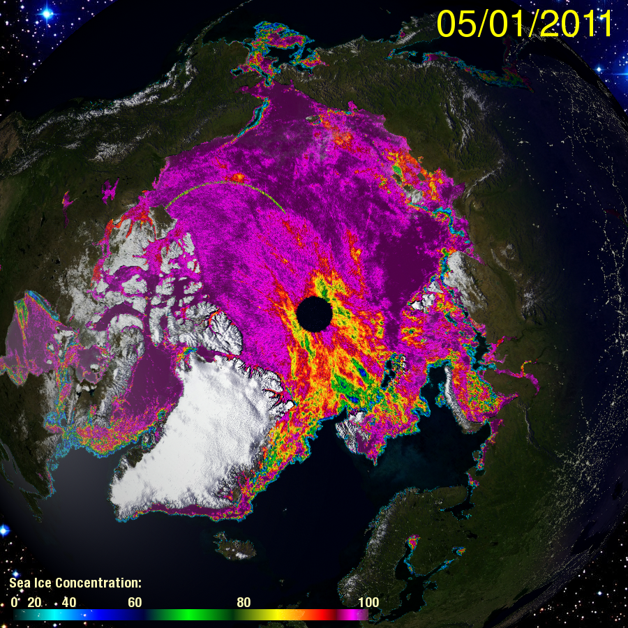 |
| Satellite view of the Arctic from Cryosphere Today site. Note the multi-colored Arctic showing that the ice is not 100% covering the water. This is new. |
If you look at the ice area for May 1, 2007, you will see that the ice completely covered the ocean. The Arctic set a record low summer ice minimum. Since 2011 is starting with thinner and less ice coverage than in 2007 the record sea ice minimum should be easily broken this year.
I suspect that we are seeing a new pattern of ice melt. If this pattern repeats itself next year, then it is likely that it is a permanent change. Permanent, that is, until there is no ice in the Arctic.
No comments:
Post a Comment